CEETO Maps
The CEETO Maps aim to disseminate some project outcomes, such as some innovative practices for a sustainable tourism and the location of the project´s Pilot Protected Areas where the Pilot Actions will be tested.
These Maps were produced to provide a clear and visual reference of the extension of the project and some of the most relevant places that have been considered for its implementation, both for places of reference from which sustainable tourism practices have been extracted and for Pilot Protected Areas in which the innovative models for sustainable tourism management will be tested.
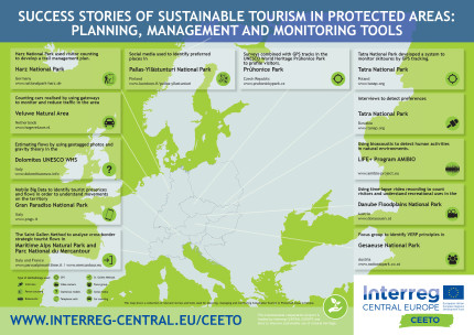
Map of Success Stories of Sustainable Tourism in Protected Areas: Planning, management and monitoring tools
This first map display some of the outcomes of the Handbook of successful and innovative practices for a sustainable tourism inside Protected Areas, which was produced during the Diagnosis Phase of CEETO project, and displays some of the locations where some of the most relevant Sustainable Tourism planning, management or monitoring tools have been identified.

|
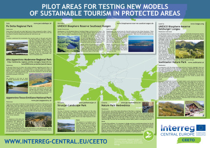
Map of Pilot Areas for Testing New Models of Sustainable Tourism in Protected Areas
This second map provides a visual overview of the location of the 8 Pilot Protected Areas that were selected within CEETO project to test the innovative models for Sustainable Tourism management in Europe.

|
Each Pilot Protected Area counts with specific Action Plans, which include different objectives and challenges. Further information on the Protected Area and their Pilot Actions can be found below:
- Regional Park of the Po Delta, Italy
- Alto Appennino Modenese Regional Park, Italy
- Appennino Tosco Emiliano National Park, Italy
- Söelktäler Nature Park, Austria
- UNESCO Biosphere Reserve Salzburger Lungau, Austria
- UNESCO Biosphere Reserve Southeast Ruegen, Germany
- Nature Park Medvednica, Croatia
- Strunjan Landscape Park, Slovenia
