Pilot Catchment in Slovenia
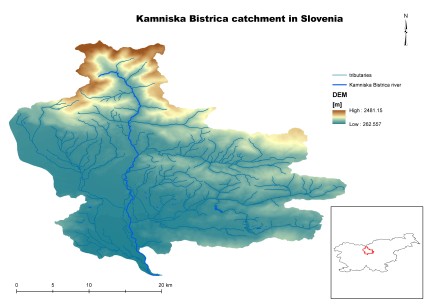
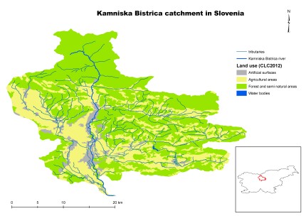
The Kamniska Bistrica River catchment was chosen as a pilot catchment because of its diverse character, ranging from wooded subalpine hills to lowland plains, which are highly urbanized. The main problem within the catchment are relatively frequent floods. As for water quality, Kamniska Bistrica River has moderate to very good ecological status. Although a large part of the settlements are connected to a sewage system and central WWTP, water in lower parts of the catchment is occasionally polluted, especially in summer months when the main channel is almost dry and the water temperature rises. Other sources of water pollution are sewage overflows during flood events. In its middle and lower part, Kamniska Bistrica River is highly regulated due to its hydropower potential and as protection against floods. This part of the catchment is covered with a dense network of artificial channels that used to supply water for the operation of water- and sawmills. Today, they are mainly used for supplying small hydropower plants.
| Characteristic | Unit | Value |
| Character of catchment | Upper part: highland; wooded, sparsely populated Middle and lower part: lowland; highly urbanized | |
| Catchment size: | km2 | 539 |
| Average flow low/avg/high* | m3/s | 2.2/7.9/67.2 |
| Extreme flow low/high* | m3/s | 0.9/282 |
| Annual precipitation low/avg/high** | mm | 998/1383/1851 |
| Annual air temperature min/avg/max** | ºC | 9/11/13 |
| Agriculture area | % | 34.5 |
| Urban area | % | 8.2 |
| Forest area | % | 54.1 |
| Open spaces with little or no vegetation | % | 2.8 |
| Open water area | % | 0.4 |
| Flooded area (1/100 years) | km2 | 39.2 |
| Artificial drainage area | km2 | 12.7 |
| Ecological status | water body | Moderate (4/5) to very good (1/5) |
| Major problems to achieve good ecological status | Hydromorphological alteration |
The catchment area will present a testing ground for: a) the GIS valorization tool (for mapping potential locations of N(S)WRM), b) the static tool (for accessing the effectiveness of N(S)WRM), and c) the dynamic tool (for calculating the dynamic effects of N(S)WRM). For the latter action, we will use RiverFlow2D, a combined hydraulic and hydrologic flexible-mesh model. Finally, a Decision Support System (DSS) for improving N(S)WRM planning will be prepared on the basis of the lessons learned from the pilot catchment.
The analysis of Kamniska Bistrica River catchment will result in the improvement of functionality and design of the created valorization tool. Valorization maps for various problems (especially floods) will be prepared for this catchment. The experience gained from the tool application will be used to prepare: a) guidelines for improving water balance by applying a system of N(S)WRMs, and b) an implementation plan based on the cost-effectiveness analysis. Stakeholders involvement will be achieved through their engagement in the development of the tool.


