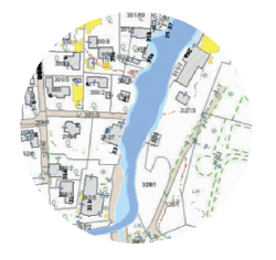
Mapping Risks
What is the Work package about?
In a first step, the partnership will develop methods to assess heavy rain risks under different categorized physical conditions and land uses of areas in Central Europe. Thus, e.g. adapted methods for urban and rural land uses in mountainous and low land, settings etc. will be specified. The tool will support the identification and communication of high risk areas.
The outputs create the fundament for public authorities to adapt their regional and local development to the existing risks and by this to improve their management capacities.

Publications:
- Sauer, Axel; Körte, Lisa; Ortlepp, Regine. (2017).
Parameter uncertainties in flood hazard analysis of heavy rain events - Leitner, Stefan; Maier, Roman; Sauer, Axel; Jöbstl, Cornelia; Ortlepp,
Regine; Hornich, Rudolf; Muschalla, Dirk. (2018).
Integrated urban flash flood risk assessment. In: Mannina, Giorgio (ed.): Proceedings of 11th International Conference on Urban Drainage Modelling, page 591. - Sauer, Axel; Körte, Lisa; Ortlepp, Regine. (2018).
An uncertain buisness: Mapping flood hazards caused by heavy rain. In: Beton- und Stahlbetonbau International Probabilistic Workshop 2018, page 95.
