Slovakia
DESCRIPTION OF THE STUDY AREA
Žitný Ostrov area is located in the SW Slovakia. Geographically it is the part of Podunajska Lowland. From geological viewpoint it is characterized by fluvial Quaternary sediments with a thickness up to 200–500 m, below Quaternary sediments (loamy sands, sandy gravels, sandy clays, and clays). The hydrogeological conditions are influenced by the great thickness of the Quaternary sandy gravels.
Depending on the grain composition of aquifers, the values of hydraulic conductivity of rocks forming aquifers ranges from 10-2 to 10-6m.s-1. The Danube River is the source of constantly replenishing groundwater supplies.
The current hydrological conditions are strongly influenced by the construction of the Gabčíkovo Water Structure. Hrušov Reservoir (upper part of Gabčíkovo Water Structure) causes new possibilities of water uptake from left-hand seepage canal. This canal supplies the canal network of Žitný Ostrov consisting of six main partially interconnected canals which are intersected by small canals.
The land use of the area is devoted mainly to agricultural purposes. Podunajska Lowland area is supposed to suffer from droughts according to long-term predictions.
The pilot site area is delineated by Gabčíkovo-Topoľníky, Vojka-Kračany and Šuľany-Jurová canals with technical possibilities for water flow control, i.e. creating Recharge Dam MAR type.
The main purpose of the pilot site measurements is to investigate the hydraulic properties of rocks, relationship between surface water and groundwater, and its lateral range of influence. Based on the field research data, the future conditions will be evaluated by mathematical modelling (MODFLOW and HYDRUS models). Furthermore, the potential amount of infiltrated water is supposed to be estimated. Based on these investigations, the feasibility study on managed aquifer recharge for agricultural purposes will be prepared.
PILOT STUDIES
Slovak pilot site is situated in porous aquifers in agricultural landscape. The aim of the feasibility study is to study the possibilities of recharge groundwater in shallow aquifers by water from canals, to store it in aquifers and search for benefits in using it in water shortage periods.
The field research is carried out by the Water Research Institute and the Slovak University of Technology in Bratislava.
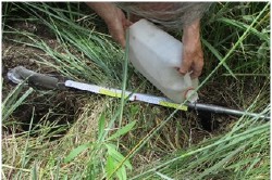
The aim of the field research is to investigate the hydraulic conditions of the rocks surrounding the canals and in the canals (bottom and banks) that allow recharging the groundwater. Soil hydraulic conductivity is an important parameter for identification of the soil type. Knowing specific soil type is the crucial input parameter to HYDRUS model. To this end, two methods used to determine hydraulic conductivity of soil will be - the auger hole method (performed in the field) and soil sampling by Kopecky cylinder to determine the soil hydraulic conductivity (performed in laboratory). The samples by Kopecky cylinder will be taken also from bottom and banks of canals. The field investigations are in process, the results have not been available yet.
Furthermore, an experiment to measure real volume of surface water recharging groundwater resources will be conducted in a selected section of canal between two sluices, i.e. creating recharge dam. This will be verified by calculation of potential water infiltration based on hydraulic properties of the rocks.
Colleagues from the Slovak University of Technology have already started field works, in order to fulfil the main goal of the DEEPWATER-CE project. The field measurements will analyze the interaction in surface and subsurface flow in Žitný ostrov region where more than 2500 km of drainage canals exist. The first measurements were made at the beginning of October 2020 continuing till November 2020.
Field measurements dealt with natural state (no technical interference) and artificial state (using sluices) of water level and discharge regime in a part of Žitný Ostrov region. These measurements will provide data to set boundaries and determine initial condition for numerical modelling of the surface and groundwater flow interaction, calibration of model related to surface water levels as well as for creation scenarios of possible groundwater recharge in pilot area via technical regulation. FLO-MATE and FLOW-TRACKER devices were used for discharge measurements.

