Dübener Heide Nature Park
Green Infrastructure Strategy & Action Plan
Strategy Development
Step 1: Transnational GI assessment and identification of priorities
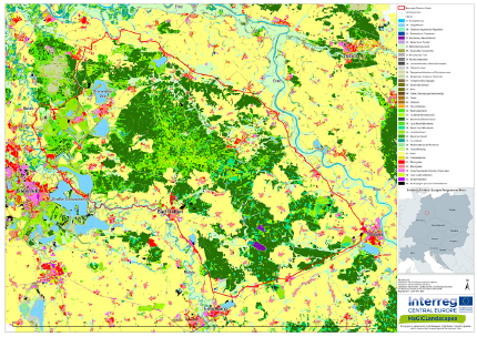
The transnational cartographic survey was the first step towards gaining an understanding of land use in the Dübener Heide. The CORINE (Coordination of information on the environment) land cover dataset (CLC) was used for this purpose. It was shown that a large part of the Dübener Heide consists of green infrastructure in the form of woodland (coniferous, mixed and deciduous), meadows, pastures, floodplains, post-mining lakes, rivers, and bogs. Many urban and village structures are interspersed within the green infrastructure and agricultural areas.
At this level of analysis it was already apparent that there was a specific need for networking and connecting the green infrastructure elements, both with each other and the settlement areas.
In a second step, the production of maps with more detailed regional data from Saxony (BTLNK - 2005), Saxony-Anhalt (BTNT - 2009) and Brandenburg (BTLN - 2009) showed a more heterogenic mosaic of land uses and biotopes in the area.

[1] Green infrastructure map of Dübener Heide Nature Park
Step 2: Functionality assessment
Using the Guidos Toolbox, various connectivity and functional assessments for GI were carried out. Areas of green infrastructure were defined as core areas and their connections, networks, corridors and their location relative to each other were presented as "bridges", "branches", "loops" or "islands". Using this information so-called focus areas were selected for further investigation and mapping and analysis. The Dübener Heide with its near-natural and structure-rich forest core areas, moorlands and many lakes, rivers and streams has good to very good natural connectivity, but these are highly influenced by anthropogenic activities. In addition, many re-naturalisation processes are currently taking place. Nevertheless, the potential for improvements of the green infrastructure was identified in some areas. For example, rows of trees, hedges and shrubs could be created along local roads connecting the core areas of the green infrastructure. The agricultural landscape could also be adapted to help connectivity, as well as other ecosystem services. The floodplain areas along the rivers Elbe and Mulde and the numerous streams also represent important habitats and habitats that perform a wide range of ecosystem services and could be improved and protected. Another important aspect is the creation and maintenance of near-natural green spaces in settlement areas and the connection of urban areas with the immediate surroundings and core areas of green infrastructure.

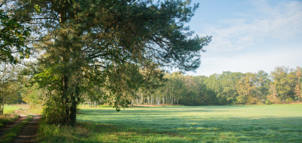
[2] Characteristic elements of green infrastructure |

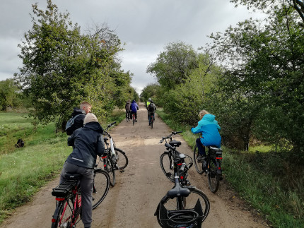
[3] Establish new GI elements along cycle routes across the Nature Park |
Step 3: Assessment of public benefit
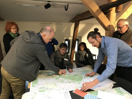
Two workshops were held with local stakeholders including the nature park administration, regional management, regional planning associations and landscape conservation associations. In addition many consultations and discussions with associated partners took place on site. During these meetings the strengths, needs, risks and opportunities for the expansion and improvement of GI were specifically identified and demonstrated (e.g. by thematic mapping on large-scale maps of the Dübener Heide).
Current and future projects, development perspectives and various scenarios were also discussed as were expectations of increasing the supply of public services. Information on where valuable elements of green infrastructure are located and how the respective public benefits are currently assessed, as well as the process of updating the nature park plan, also played an important role in the discussions. During discussions it became apparent that there is a particular deficit in communication, perception and identification with GI in the Dübener Heide Nature Park and surrounding areas.
At the end of the first process of the PBA tool it was possible to produce a series of maps showing the geographical distribution of the public services provided by the GI network and the benefits derived from them.

[4] Stakeholder workshop in Bad Düben in November 2019
Photo credits: Verein Dübener Heide e.V. [Header], Martin Neuhof [2], Sven Riedl [3], Anke Hahn [4]
Back to GI STRATEGY & ACTION PLAN | WP3 OVERVIEW | MAIN PAGE
