Krkonoše National Park
Green Infrastructure Strategy & Action Plan
How the strategy was developed
Step 1: Transnational GI assessment and identification of priorities
A series of discussions with local (municipalities, businesses, ski centres), regional (regional and districts administrations) and national (Ministry of Environment, universities and research institutions) stakeholders identified key priorities for GI of KRNAP case study area. They include preserving biodiversity, reducing fragmentation without reducing the recreation functions of the landscape, improving water management in the landscape and mitigation against climate change.

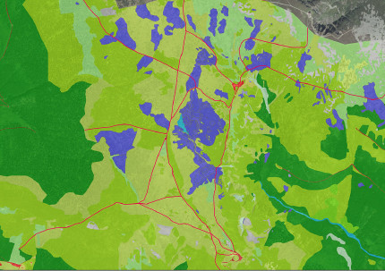
[1] Peat bogs are an important habitat, seen here in purple among the Arctic-alpine tundra of grassland and dwarf pines in green, and are heavily fragmented by a dense network of tourist paths shown in red.
Step 2: Functionality assessment
The next stage was to analyse the landscape functionality using the outputs of Work Package 1 (mapping) and simple to use software. Using the results of the GI functionality analyses, specifically connectivity, habitat function and fragmentation indexes, key landscape services were identified as well as locations characterised by a reduced functional value, which in turn provided focus areas.
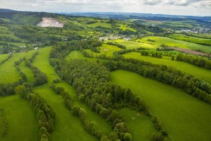
Although KRNAP appears on the surface to have high values for most landscape services, there is a risk of this decreasing due to high level of landscape fragmentation in the lower areas, those surrounding the main tourism centres. The habitat and refugium functions are most at risk. It necessary to keep original landscape structure (formed by strips of woodland – see Fig. 2) in the lower parts to connect areas with other protected areas in the region.

[2] Landscape structure of the lower parts of the KRNAP case study area. The thin strips of woodland shown here help to connect habitats for key species.
Step 3: Assessment of public benefit
The assessment of public benefits was helped by the existing long-term cooperation between KRNAP Administration, the most important authority regarding nature conservation in the park, and others local and regional stakeholders.
The key topics of green infrastructure were discussed during regular meetings with the mayors of municipalities and the representatives of the KRNAP Administration in Vrchlabí.
The most important issues surrounding GI have been incorporated into the production of statutory strategic documents for which the KRNAP Administration is responsible.
This was necessary because nature conservation authorities prioritise “environmental” benefits (conservation and biodiversity, water management), while most municipalities and others (e.g. ski centres) favour those GI functions and benefits associated with recreation and tourism.
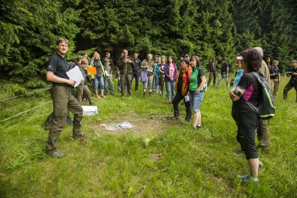
The identification of the significant benefits of GI was supported by the outputs of Work Package 2 (functional landscape analyses) and other research and preceding long-term monitoring results arising from many internal and external projects. This research also helped identify GI elements and locations with the largest intersection of multi-sector of benefits were to be found. Field trips with local authorities proved to be very useful tool in explaining the benefits and functions of green infrastructure [3].

[3] Field trip with stakeholders to discuss public benefits and landscape services of key GI elements, in this case a forest meadow in Sklenářovice.
Photo credits: GI map of KRNAP, Consolidated Layer of Ecosystems [1], KRNAP/Kamila Antošová [Header, 2, 3]
Back to GI STRATEGY & ACTION PLAN, WP3 OVERVIEW or MAIN PAGE
