Medieval harbour, Municipality of Puck, Pomeranian voivodeship (PL)
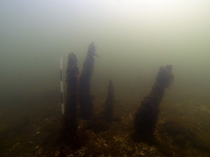
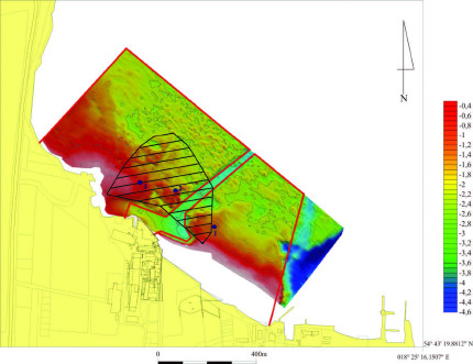
The remains of a submerged medieval harbour in Puck were discovered during an archaeological investigation of the site in the late 70’s being one of the most important underwater archaeological sites in Poland. Over an area of 12 ha a great number of relicts like the remains of the harbour construction, wrecks, potsherds or bones were found. According to them the harbour was in use between the 10th and 13th centuries, probably it was the largest early medieval port on southern Baltic coast. Nowadays, the remains are located around 250 m away from the coastline, anchored at the maximum depth of 2,5 m. In 2014 the site has been registered as submerged archaeological ground monument and therefore is the first underwater archaeological site in Poland put under such protection. The Town of Puck is local owner and holder of the archaeological heritage on its territory.

THREATS AND OPPORTUNITIES
Natural changes and factors occurring on the pilot site, as well as conflict of different interests contribute to the fact that managing and protection of this underwater harbour is a very difficult task. The natural conditions and the low water level may cause the destruction of the preserved structures. Significant impediments are also extension and location in direct vicinity of a used coastline. A potential development of water sport offer may also bring some negative effects on the underwater heritage. Moreover, as a result of wave pounding some of the precious elements detached to the seabed or other elements of construction may simply be lost by natural reasons. Furthermore, an expansion and reconstruction of the harbour for facilitating its fishing, tourist and seafaring functions is planned. However, the medieval harbour offers multiple changes as local tourism attraction and educational accessibility to the site will support cultural participation as well as local and regional identity.
PLANNED PROSPECTION / VISUALISATION ACTIVITIES
First step of planned activities will be gathering and analysing data from previous excavations. Next step will be hydro-acoustic survey using high resolution multi-beam sonar. Thereafter, photogrammetric documentation of chosen parts of archaeological site will be created. Last part will be connection and make over all collected data. Results of all prospection actions will be visualisations, animations and 3D models of underwater archaeological site and reconstruction of the medieval port. The outcome will be also presented in the local maritime museum. The city of Puck will set up local outdoor information points aimed at tourists and local population sharing via WIFI visualized information on mobile devices. The results of the project will be integrated in local guidelines and directives. It is expected that project results will support capacities of the town in use and protection of archaeological heritage.

STAKEHOLDERS INVOLVED IN THE PROJECT
For the project implementation it is necessary to cooperate with regional and maritime administration, including institutions like Marshal's Office of Pomeranian Voivodeship or Maritime Office in Gdynia. Local population, tourism companies and institutions as well as important stakeholders like the National Maritime Museum in Gdansk as collection and research institution of historical maritime artefacts will be also included in the project.
REGIONAL STRATEGY
Klick here for the planned regional strategy (after project ending).
