Karkonosze National Park & Jelenia Góra Basin
Green Infrastructure Strategy and Action Plan

|

CSA Karkonosze National Park and Jelenia Góra Basin |
Description of the area
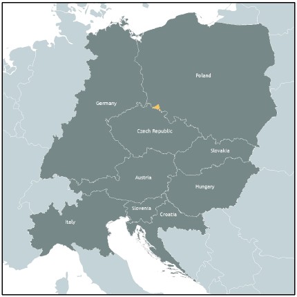
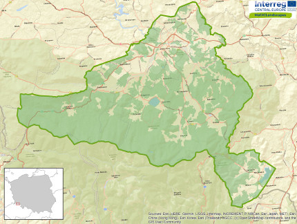
The Jelenia Góra Basin, together with the surrounding Karkonosze, Rudawy Janowickie and Kaczawskie Mountains, is a special landscape, beautiful and valuable both from the natural and cultural point of view. The turbulent history of this region, changes in the national identity and related influences of different nations and customs has resulted in a diverse cultural landscape, shaped in an area of above average natural value. Towns and villages nestle among a natural mosaic, consisting of mountains and valleys, forests and fields as well as marshes and ponds. The largest city in the valley - Jelenia Gora (about 75,000 inhabitants), forms an agglomeration with cities lying at the foot of the Karkonosze Mts. (Kowary, Karpacz, Piechowice and Szklarska Poreba - between 5,000 and 10,000 inhabitants) and also with villages of very different sizes. The green areas are well preserved and varied, which is of great importance for the protection of biodiversity and landscape. They include elements both strongly shaped by man: urban parks, squares, allotment gardens, as well as economic forests, agricultural areas, and semi-natural and natural ecosystems in the highest parts of the mountains. The most valuable areas have been included in the Natura 2000 network, including the Karkonosze National Park - the area with the largest nature protection regime in Poland. The area of the Jelenia Góra basin is also known as the "The Valley of Gardens and Palaces". - with palace and park complexes of the highest historical and cultural values. The most important factor in the development of the area has become tourism, the intensity of which can be observed in the area of the Karkonosze (Karpacz, Podgórzyn, and Szklarska Poręba). In Jelenia Góra, the main city in the area, industrial zones and service centres are more important.
Issues
The intensive development of tourism, seen during the economic transformation of the 1990's as a basis for development for the region, has recently been recognised as a threat for local nature. It is estimated that the region is visited by about 4 million tourists per year, of which the Karkonosze Mountains alone attract over 2.5 million. The Karkonosze National Park has the highest density of hiking trails of all of the Polish national parks and some of the most attractive places, such as the highest peak of Sniezka (1,603 m), which at the same time the highest natural value. The most valuable ecosystems and unique species are relatively easily accessible and subject to tourist pressure practically all year round, both in summer (hiking) and in winter (skiing). Negative influence is connected with constant presence of people, trampling places off the trails, litter and also with inefficiency of water and sewage management in mountain hostels. A consequence of the tourist pressure is also the expansion of sub-montane areas, especially large buildings: hotels and apartments. The ease of transforming agricultural land, especially mountain meadows, which, as a result of the withdrawal of agriculture, are used for building development, results not only in the impoverishment of habitats, but also in the fracturing of local ecological corridors. In the areas abandoned by agriculture, invasive vegetation appears. More and more frequent periods of drought combined with intensive water uptake from the mountain results in a lack of natural flow. Regulated rivers, especially in urban areas, increase the speed of the outflow of water. There is less and less retention due to the development and drying-out of wetlands, drainage of land and drainage of rainwater directly into storm channels.
Challenges
A big challenge for the development of green infrastructure is its popularisation and implementation in the spatial planning process. Due to the lack of legal rights for green infrastructure, this challenge is mainly related to its promotion both among the region's authorities, investors and residents. The challenge is to convince everyone how many benefits are delivered by the creation of sustainable investment concepts and local plans, which, in addition to the grey infrastructure, preserve or create multifunctional elements of the GI, secure compensatory actions or landscape values. The challenge in areas where greenery is relatively abundant and accessible is to preserve it by setting boundaries for sustainable landscape use. Sometimes it is much easier to gain support for costly implementations based on green infrastructure than to maintain elements of already existing natural greenery. The challenge is also to introduce GI topics, ecosystem services, into education that, in addition to knowledge of the benefits of GI, would create a sense of spatial order and explain the role of public participation in the spatial planning process.
HOW THE STRATEGY WAS DEVELOPED
Outline of key themes, priorities and directions for the GI Strategy and Action Plan
One of the key benefits of the project itself and the beginning of one of the strategy's objectives was the creation of a cross-sectoral forum where the needs of shaping green infrastructure were discussed in the form of workshops. In the region of the Karkonosze and Jelenia Góra Basin the GI areas are quite well preserved and are largely under area protection, so most of the proposed actions focus on how to preserve the GI in the face of pressure from tourism, buildings or climate change. These are quite difficult topics, as they are usually related to the introduction of restrictions and the need to define the boundaries for maintaining healthy ecosystems and functioning networks. These topics are close to institutions responsible for nature protection, but also more and more often to local associations, which care about preserving the natural and landscape values of the places where they live. The plans of local governments are primarily related to the maintenance, revitalisation or creation of urban green areas and thus adaptation to climate change. Therefore, the most important goals of the GI Strategy include: shaping ecological connectivity and improving the state of biodiversity, improving water management, implementing the GI concept in improving local spatial planning and building partnerships for the GI in the region.
GI Benefit | Strategic Tools/Policies | Partners |
| Conservation benefits | - Plany ochrony parku Narodowego, parków krajobrazowych, obszarów Natura 2000 | - Regionalna Dyrekcja Ochrony Środowiska |
| Health & Well-Being | - Strategia rozwoju Miasta Jeleniej Góry na lata 2014-2025 | - Miasto Jelenia Góra |
| Water management | - Kompleksowy projekt adaptacji lasów i leśnictwa do zmian klimatu – mała retencja oraz przeciwdziałanie erozji wodnej na terenach górskich. | - PGLLP Nadleśnictwo Szklarska Poręba, Śnieżka, |
| Education | - Statut Towarzystwa | - Zachodniosudeckie Towarzystwo Przyrodnicze |
Key Players/actors in delivering the strategy and those that support its implementation
Many of the key institutions and local governments in the Karkonosze and Jelenia Góra Basin have been involved in the preparation of strategies and action plans. In addition to the associated partners defined in the project, it was possible to involve active residents - members of associations that implement many projects supporting the GI. The GI Strategy is the first study on green infrastructure in the region, which as well as providing general directions for the future also demonstrates specific implementation ideas. We hope that they will become a mutual inspiration for further actions, help in updating the planning documents and elaboration of plans e.g. city climate change adaptation plans, in which green infrastructure is one of the most important tools.
Expected benefits
The implementation of strategies and action plans will allow us to maintain the attractiveness of the landscape and natural resources of the region. Maintaining green links and open areas not only enables the migration of animals, but also shapes the spatial order, preventing the dispersion of buildings, which burdens additional costs on local governments. Any measure improving landscape retention may prove to be a priority for the difficult to predict effects of climate change. The benefit in regulating the urban climate can be gained by revitalising and increasing the area of green spaces in cities, which will also improve the quality of life of residents. Cross-sectoral partnership, the promotion of public participation and the expansion of education on the functions and benefits of GI can result in further projects to improve GI and will indirectly also strengthen local identity for residents.

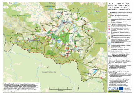
GI Strategy Map of Karkonosze National Park and the Jelenia Góra Basin
GI STRATEGY & ACTION PLAN KARKONOSZE NATIONAL PARK & JELENIA GÓRA BASIN
Contact
Karkonosze National Park Administration
sekretariat(at)kpnmab.pl
https://kpnmab.pl/magiclandscapes
Header photo: M. Wojnarowicz
Back to WP3 OVERVIEW | CASE STUDY AREA | MAIN PAGE
