Karkonosze National Park & Jelenia Góra Basin
Green Infrastructure Strategy & Action Plan
Strategy Development
Step 1: Transnational GI assessment and identification of priorities
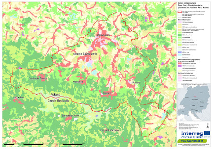
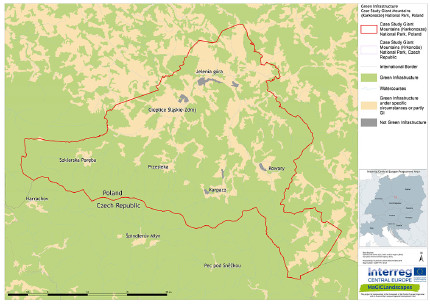
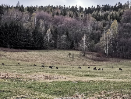
This stage was the first step to understand the idea of green infrastructure, an opportunity to check if and how it functions in Polish law and policies developed in the region. This stage also included the identification of the GI network in the area of Karkonosze and Jelenia Góra Basin. On the basis of available GIS data maps were produced, which show the spatial distribution of GI elements and places where GI is missing. For this purpose, the publicly available data of CORINE area coverage and topographic data 1:10 000 were used. For the mesoregion of the Karkonosze Mts. an additional detailed ecosystem map was created, for which the European classification system EUNIS (level 3) was applied. For this area, elements of green infrastructure such as linear woods, marshes, field borders, buffer zones along streams were also mapped. The knowledge on the ecological functions of these small GI elements is still too low. It was increased during workshops, where local governments and institutions responsible for shaping the GI in our region met. One of the main conclusions of the workshop was that it is necessary to implement the idea of GI in spatial planning as soon as possible in order to maintain ecological connnectivity, to protect functionally important elements of GI and – what is important in the mountains - landscape values. Additionally, during consultations with stakeholders, the need to develop a strategy how to keep meadow habitats located in lower locations of the Karkonosze, within the Natura 2000 area, was stressed.

[1] GI Map of the case study area based on Corine Land Cover |

[2] GI or not GI - based on Corine Land Cover |
Step 2: Functionality assessment
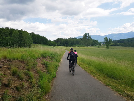
The essence of green infrastructure, which also comes from its definition, is to shape the GI as a network. The links are important both for the migration of animals and plants (ecological corridors), but also for man (potential for marking out green routes: bicycle paths, walking routes). The analyses made in the GUIDOS program illustrated the condition of the GI network in the area and indicated areas important for maintaining connectivity e.g. between Natura 2000 areas. Additionally, planning documents from all municipalities were analysed in order to assess potential threats to connectivity in the case of implementation of planning records. In some places it may be completely interrupted or significantly reduced by new developments. Appropriate legal implementation is needed to protect these strategic connectivity sites. The functionality of green infrastructure based on landscape services has also been assessed. Due to the fact that the GI areas occupy about 70 % of the CSA and a significant proportion of them are forest areas, and high values of landscape services have been recorded in a relatively large area. Places where it is advisable to take measures to strengthen e.g. regulatory services mainly concern dense urban development or industrial and commercial areas.

[3] Green cycle routes |

[4] Mountain meadows as habitats and part of ecological corridors used by deer |
Step 3: Assessment of public benefit
The services provided by ecosystems are human benefits. Therefore, it is very important to show the value of green areas through the prism of specific benefits. The associated partners of the project in the framework of the consultations indicated the following priorities: clean air, prevention of natural disasters, and improvement of water management and preservation of the aesthetic features of the landscape. Nature protection institutions also mentioned the need to maintain and shape ecological connectivity as a condition for biodiversity. A survey was also conducted among the inhabitants of Karkonosze towns and cities. In this group, air quality, the influence of greenery on the harmony and beauty of the landscape, water retention and purity were also repeated. There were also proposals for actions that support these benefits: revitalisation of existing parks, squares, planting of trees, e.g. species characteristic for the village. Some of the tasks can be carried out within the commune, in cooperation with active communities, the others require inter-communal cooperation with many institutions or landowners, e.g. planning a network of bicycle paths or protecting ecological connectivity.
Photo credits: M. Wojnarowicz [Header], KPN [2], Dorota Wojnarowicz [3], Barbara Wieniawska-Raj [4]
Back to GI STRATEGY & ACTION PLAN, WP3 OVERVIEW or MAIN PAGE
