Kyjovsko
Green Infrastructure Strategy & Action Plan
Strategy Development
Step 1: Transnational GI assessment and identification of priorities
Based on consultation with local stakeholders, three main priorities were identified within the work packages. Firstly, to identify how to improve permeability of the landscape, secondly, to upgrade data about GI and thirdly to identify gaps in existing GI in order to tackle soil erosion and worsened water retention. Two main maps were created – the map of current landscape structure that shows areas with lack of GI and map of historical landscape structure that can serve as an inspiration for restoring GI in these gaps. The map of current landscape structure was based on combination of several sources of regional data and manual digitising, while the map of historical landscape structure was based on stable cadastre.
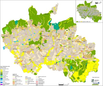
[1] Historical GI map of the Kyjovsko region |
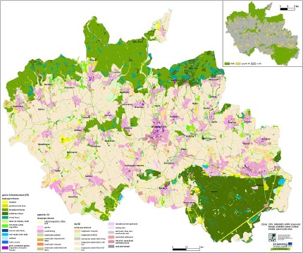
[2] GI map of Kyjovsko region 2017 |
Step 2: Functionality assessment
The Functionality Assessment predominantly focused on identifying areas with low connectivity and permeability. Connectivity can be enhanced by full implementation of the TSES. With regard to the challenges identified, a digital layer of TSES for the whole case study was created and used in a further functionality assessment. It was based on computing Euclidian distances and morphological spatial pattern analysis (MSPA). Maps of Euclidian distances showed mostly areas of large arable fields with low permeability. Further analyses of historical landscape structures revealed where the missing GI elements used to be and could be restored to increase current landscape permeability. MSPA analyses then identified which non-existing elements from TSES would help in increasing connectivity, if realised.
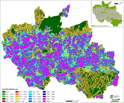
[3] Map of Euclidian distance (left) revealing localities with impermeable landscape (purple) |
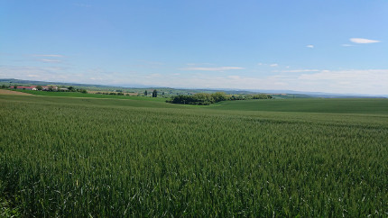
[4] Currently unrealised TSES bio-corridor that would help increase GI connectivity |
Step 3: Assessment of public benefit
Two separate actions were undertaken in order to assess priorities/ areas and benefits. One element dealt with meetings with stakeholders and discussing their needs, the other focused on the assessment of existing strategic documents. Meetings were held with mayors from the region’s municipalities as well as the interested public. Both groups of stakeholders identified several areas where GI implementation would help in improving landscape permeability, retention and connectivity. With regards to strategic documents, 27 documents were assessed, with a focus on GI related themes and their relation to benefits. These themes can be grouped to infrastructure (e.g. cycle paths, nature trails, field roads), concepts (e.g. land consolidation, erosion control measures, education), water (e.g. ponds, flood control measures, renaturalisation of streams and rivers), and planting greenery (e.g. village greenery, greenery outside villages, afforestation). Each theme was associated to the several benefits it can produce.
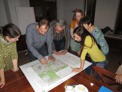
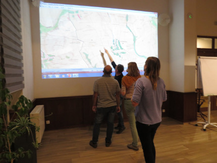
[5] and [6] Discussion with stakeholders about identifying localities that would benefit the most GI implementation
Photo credits: Hana Skokanová [Header, 4], Marek Havlíček [5], Pavla Pokorná [6]
Back to GI STRATEGY & ACTION PLAN, WP3 OVERVIEW or MAIN PAGE
