Po Hills around Chieri
Green Infrastructure Strategy & Action Plan
Strategy Development
Step 1: Transnational GI assessment and identification of priorities
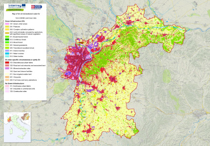
The case study area (CSA) map of green infrastructure (GI) at the transnational level, based on CORINE Land Cover data showed a large amount of non-irrigated arable lands in the south-eastern part of the CSA. The GI shown on the map corresponds mainly to the large wooded areas on the hills and to the main rivers (Po and Stura). In the plain there are settlements and transport infrastructure. The priorities were identified through a consultation with the project’s Associated Partners (Po Park, Piedmont Region and Chieri Municipality). The Po Park Management Body proposed to update the Park Plan and to draft a Plan (Operational Territorial Project) which includes the Po, Superga and Bosco del Vaj parks and to link the hills to lowlands in the west and to the south of the CSA. The main expectation is the development of an analysis model and the design/management of GI which is both understandable and easily used by local administrations.

[1] Green infrastructure map of the case study area "Po Hills around Chieri"
Step 2: Functionality assessment
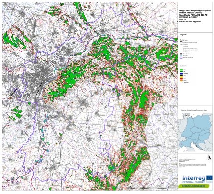
As a first stage the Piedmont Land Use Land Cover (2010) was used and then integrated the LCP with more detailed and recent data to create GI maps. Using GUIDOS toolbox, a map was then produced the showing core areas, islets, bridges and loops. The MSPA (Morphological Spatial Pattern Analysis) map correctly recognised that the core areas are restricted almost exclusively to the most extensive and the most intact hilly wooded areas. The rest of the hilly woods areas are classified as corridors (red), since they are extremely fragmented. The other core areas are located in the flood plain correspond with the Natura 2000 network sites. The Landscape Services and Benefit analysis confirms previous assessments.

[2] Result of the MSPA analysis in the case study area “Po Hills around Chieri”
Step 3: Assessment of public benefit
Stages of Assessment are: evaluation of territory critical issues, weaknesses and threats and their general representation on a map; strategies analysis (an in-depth analysis of the work done in WP1); localisation of specific objectives to be pursued in the various areas of the CSA. Then we held a stakeholder consultation including institutional stakeholders and associated organisations/associations). During the workshop we gave each participant a questionnaire containing the list of benefits/effects provided by GI and we asked them: a) to select the 5 effects/benefits produced by GI which they consider most important; b) to localise the benefits (whole area or a specific location); c) to briefly describe which instruments/plans or actions could be used to achieve the objectives identified. In this way we integrated our previous analyses and studies and prioritised benefits.

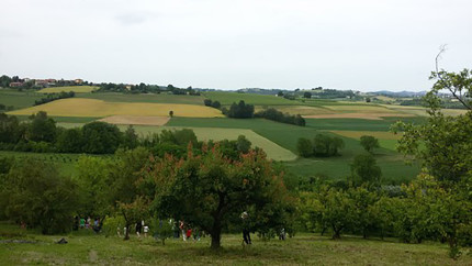
[3] Shrubby and arboreal hedgerows in agricultural areas contrasts the removal of fertile soil (windbreakers)
Photo credits: Gabriele Bovo [Header, 3]
Back to GI STRATEGY & ACTION PLAN, WP3 OVERVIEW or MAIN PAGE
