Thayatal National Park
Green Infrastructure Strategy & Action Plan
Strategy Development
Step 1: Transnational GI assessment and identification of priorities
Starting from the common, comparable data base of CORINE Land Classification (CLC), MaGICLandscapes partners supplemented this with available national and regional data. For the compound Austrian case studies this was obtained by compiling the following data sets:
- Copernicus High Resolution Layers (HRLs): High Resolution Layer - Forest Types
- Agricultural data of the Integrated Administration and Control System (IACS) and Land Parcel Identification System (LPIS)
- Digital cadastral data
- Regional waterways network
The data sets were aggregated and reclassified according to CORINE and, using various GIS-based tools, sequenced according to their thematic coverage to obtain an accurate description of land cover.
Over several workshops and meetings stakeholders identified the following issues in the surroundings of the Thayatal National Park:
- Further intensification of land use and therefore loss of valuable extensively used habitats of the cultural landscape (orchards, meadows, pastures), irrigation
- Building development, infrastructure projects, urban sprawl, land consolidation and spatial planning
- River regulation and drainage
- Disposal of waste and residual materials
- Loss of small biotopes
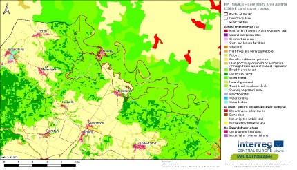
Mixed deciduous forest is the dominant type of landscape in the area (Figure 1), which is surrounded mostly by agricultural land. To keep the National Park and the inhabitants of the region healthy, the surrounding region faces major challenges in implementing a connected and functional GI network. In the intensively farmed areas elements of GI are very often limited to just linear structures, and as such, important linking elements crucial to the GI network. At the same time, GI improves the overall environmental resilience of farmed landscapes towards climate change and extreme environmental events.

[1] Regional green infrastructure map of the case study area "Thayatal National Park"
Green Infrastructure as a concept has not yet been established in Austrian legislation. Nonetheless, legal matter referring to elements of green infrastructure appears in different national and regional legislation. In Austria most of the legislation regarding nature and landscape conservation, etc. lies within the responsibility of the federal states. The only documents directly referring to GI are the Austrian Biodiversity Strategy 2020+ (Biodiversitäts-Strategie Österreich 2020+) and the Lower Austrian Nature Protection Concept (Naturschutzkonzept Niederösterreich).
Step 2: Functionality assessment
The use of detailed regionalised GI geodata revealed specific details of the landscapes’ structure and fragmentation as well as land use patterns and landscape features. Furthermore, this dataset provided an ideal basis to enhance the specific analyses of connectivity, by an additional assessment of functionality in terms of provision of landscape services. The synopsis of the results of the connectivity and functionality analysis, including sample field mapping surveys, helped greatly to identify hot spots of GI networks as well as GI with a high functional value and areas lacking such elements.

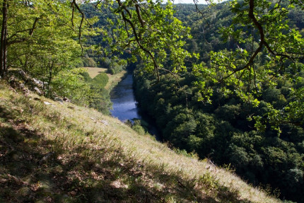
[2] Typical aspect of the Thayatal National Park
Step 3: Assessment of public benefit
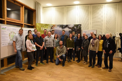
To enhance the data driven approach of the functionality assessment in Stage 2 a broad stakeholder process was implemented to integrate local needs and priorities to establish a comprehensive strategy document. By using a dual system to include stakeholder’s opinion, firstly a direct consultation of experts and institutions was conducted, to explore problems, priorities and interests, and secondly a series of more open public workshop events took place, where also individuals from various sectors could add their views. A tool for the assessment of public benefit for both of these stakeholder groups served to identify target areas as well as to prioritise GI benefits.

[3] Stakeholder involvement to highlight and prioritise GI benefits and locations
Photo credits: NP Thayatal/R. Mirau [Header], NP Thayatal/C. Ebner [2], Florian Danzinger [3]
Back to GI STRATEGY & ACTION PLAN | WP3 OVERVIEW | MAIN PAGE
