Upper Po Plain
Green Infrastructure Strategy and Action Plan

|

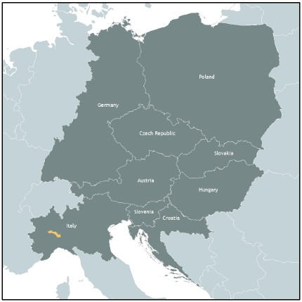
Case study area "Upper Po Plain" in Piedmont, Italy |
Description of the area
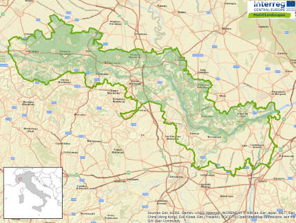
The case study area corresponds to the Tourist Area of the River Po Park - Vercelli-Alessandria stretch and includes Regional Nature Reserves and several Natura 2000 Network sites. The area is characterised by the presence of the river corridor, which runs through the territory for about 90 km. This corridor consists of the river, the riparian vegetation strips and marginal areas such as oxbows, side branches and wetlands.
On the north bank of the Po, the landscape consists of an expanse of paddy fields, within which the minor hydrographic network is very important. In addition to allowing the distribution of the water needed for agriculture, it is in itself a significant component of the green infrastructure network. In the monoculture areas, strips of lowland forest that represent the remains of the original land cover can be found. The largest area is the Bosco della Partecipanza di Trino, located in the northernmost part of the study area.
On the south bank of the river corridor, in the western area the hills are characterised by the presence of discontinuous but widespread forest cover, alternating with extensive forms of agriculture. The eastern, flat area is occupied by intensive forms of agriculture (maize, cereals), within which the natural areas, with the exception of those connected to the hydrographic network, are very scarce.
Issues
The study area is affected by extremely intense agricultural activity, which over time has been reducing more and more of the natural spaces, although small, that existed previously (tree rows, hedges, vegetated banks). This has the effects of reducing its capacity to preserve significant levels of biodiversity and ecological connectivity. As regards the main hydrographic network (the River Po and its main tributaries) and the secondary one (the minor hydrographic network), this loss of natural elements has led to a reduction in resilience capacity in the face of flood events that have been more frequent in recent decades.
Challenges
The main challenges to which the case study area is subject are first and foremost those concerning agricultural activity: identifying production methods that, while meeting the needs of financial sustainability, guarantee environmental sustainability in the short, medium and long term. The application of the "Green Deal" principles to regional rural development programming will make it possible to achieve these objectives, also by allocating a portion of the agricultural area to the creation of new natural nuclei.
At the same time, the promotion of ways of improving a territory which, in the collective imagination, doesn't present a tourist attraction but which actually hosts values of great naturalistic, historical and landscape interest, can determine the creation of new flows (both of people and of economic resources deriving from them).
HOW THE STRATEGY WAS DEVELOPED
Outline of key themes, priorities and directions for the GI Strategy and Action Plan
The activities carried out by the Project made it possible to identify the following list as Public Benefits on which to operate primarily in the study area:
GI Benefit | Strategic Tools/Policies | Partners | |
| Conservation benefits | Piano d’Area del Parco fluviale del Po | Ente di Gestione del Parco del Po | |
| Disaster prevention |
| Ente di Gestione del Parco del Po | |
| Climate Change & Adaptation | Strategia Regionale sui Cambiamenti Climatici (in preparazione) | Regione Piemonte | |
| Agriculture & Forestry | Piano di Sviluppo Rurale | Regione Piemonte | |
| Water Management | Piano di Gestione del Rischio di Alluvioni del Bacino del Po | Ente di Gestione del Parco del Po | |
| Tourism & Recreation | Piano Paesaggistico Regionale del Piemonte | Ente di Gestione del Parco del Po |
Based on interactions with local stakeholders, some priorities were defined:
- The connection through natural elements of the core areas; the connection axes that seem most relevant are those that would allow the connection between Bosco della Partecipanza and Palude di San Genuario, and those that would connect these ZSC with the river corridor;
- the recovery and strengthening of minor roads for the realisation of cycle and pedestrian tourist routes;
- improving the integrity of the irrigation network.
Key players/actors in delivering the strategy and those that support its implementation
The strategy was drawn up in collaboration with the Po Park Authority, associated partner of the Project, which is interested in achieving the defined objectives, through the implementation of specific actions. The Province of Vercelli, which has been carrying out for years activities aimed at increasing biodiversity on a territorial scale in the rice sector through direct interventions and promotion of good practices, will also be a key player in the implementation of the strategy.
Expected benefits
The implementation of the actions identified under the Strategy will allow the improvement of ecological connectivity, in particular in the rice sector, which can lead to increased biodiversity and the conservation of species and habitats that are of specific value to the case study area. It is also expected to reduce the risk of flood damage and increase the potential for sustainable use of the territory.
Download the Full Strategy Here (Italiano)

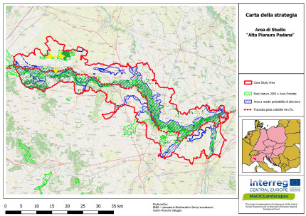
GI Strategy Map of case study area Upper Po Plain
Contact
ENEA – Laboratorio Biodiversità e Servizi Ecosistemici – Centro Ricerche Saluggia (VC)
Gian Luigi Rossi – gianluigi.rossi(at)enea.it
Ente di gestione delle aree protette del Po vercellese-alessandrino (AL)
Dario Zocco - parcodelpo-vcal(at)pec.it
Header photo: Simone Ciadamidaro
Back to WP3 OVERVIEW | CASE STUDY AREA | MAIN PAGE
