Waidhofen/Ybbs, Austria
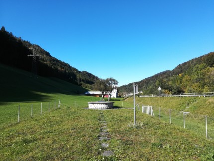
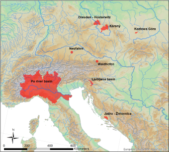
The pilot area is located 10 km south of the city of Waidhofen a.d. Ybbs in Lower Austria and is part of the eastern foothills of the Northern Calcareous Alps, with altitudes ranging from 415 to 969 m a.s.l. The area is characterized by a warm-moderate regional climate, with an annual mean temperature of 8°C and annual mean precipitation of 1379 mm (recorded at the weather station Hinterlug during the period from 1981 to 2014). The annual distribution of precipitation is bimodal with maxima during both the summer (June and July) and winter months (December and January), with snowfall
dominating precipitation in the winter. Two small fluvial systems constitute the study area’s drainage: the Waidhofenbach and the Lugerbach. Close to the Hieslwirt spring, the Lugerbach flows into the Waidhofenbach, which drains most of the study area into the Ybbs river in Waidhofen. (Bittner et al., 2018, Narany et al., 2019).
The geology is dominated by a lithologic sequence of dolomitic basement rocks (Main Dolomite, Triassic age). Significant sinkholes are not present in the study area, leading to the conclusion that point-infiltration plays a minor role for recharge. Moreover, prior investigations revealed that a deep karstified groundwater system exists, also below the elevation level of the Waidhofenbach valley (Hacker, 2003). Considering the specific hydrogeological setting of the area, we can assume a well-connected network of fractures and conduits. In total, the entire pilot area covers about 10 km². (Bittner et al., 2018, Narany et al., 2019).
5 different springs originating from the Main Dolomite are exploited by the local water works for the municipal drinking water supply of Waidhofen a.d. Ybbs, namely the Kerschbaum, Mitterlug, Hinterlug, Glashütten and Hieslwirt spring. The Kerschbaum spring has the highest mean discharge, 34 l/s, and represents the main source of freshwater. Moreover, a pumping well (Forster well) is activated during droughts to sustain the water demand
of Waidhofen a.d. Ybbs. Each of the described springs is fed by karst aquifers of the Main dolomite, where the karst system of the Hinterlug spring is separated tectonically from the two others by a pronounced strike-slip fault that separates the two mountain massifs Schnabelberg (Hinterlug spring in northern part) and Glashüttenberg (Kerschbaum, Mitterlug, Hieslwirt and Glashütten spring in southern part). Along the Waidhofenbach, several small settlements and industrial infrastructures exist, exhibiting pressure on the creek and potentially on the springs located close to it, e.g. the Kerschbaum spring.
Cluster 2: Groundwater
Pilot Action responsible: BOKU, PP12


PILOT ACTION CLUSTER 1 PILOT ACTION CLUSTER 2
Surface water: Groundwater:
KOZŁOWA GÓRA, POLAND KARANY-JIZERA, CZECH REPUBLIC
PO RIVER BASIN, ITALY LJUBLJANSKO KOTLINA, SLOVENIA
DRESDEN - HOSTERWITZ, GERMANY NEUFAHRN MUNCHEN, GERMANY
PILOT ACTION CLUSTER 3
Karst water:
JADRO CATCHMENT, CROATIA
WAIDHOFEN/YBBS, AUSTRIA
Bittner, D., Narany, T. S., Kohl, B., Disse, M., & Chiogna, G. (2018). Modeling the hydrological impact of land use change in a dolomite-dominated karst system. Journal of Hydrology, 567, 267-279.
Hacker, P., 2003. Hydrologisch-hydrogeologische Untersuchungen im Bereich des Glashüttenberges zur Frage des engeren Schutzgebietes für die Kerschbaumer-Quelle. ARC Seibersdorf research GmbH.
Narany, T. S., Bittner, D., Disse, M., & Chiogna, G. (2019). Spatial and temporal variability in hydrochemistry of a small-scale dolomite karst environment. Environmental Earth Sciences, 78(9), 273.
